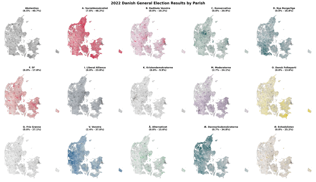
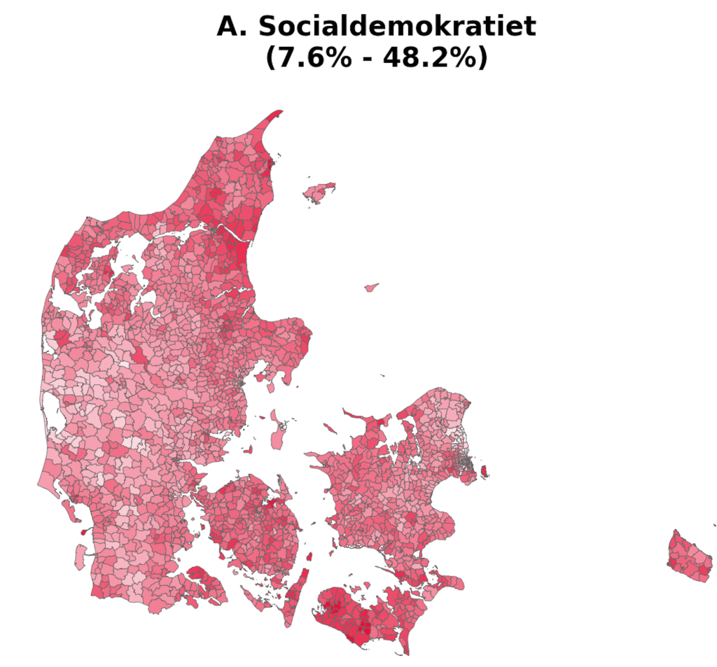
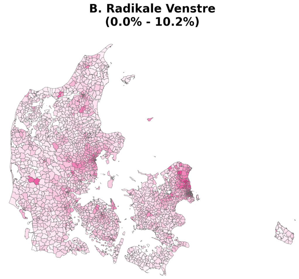
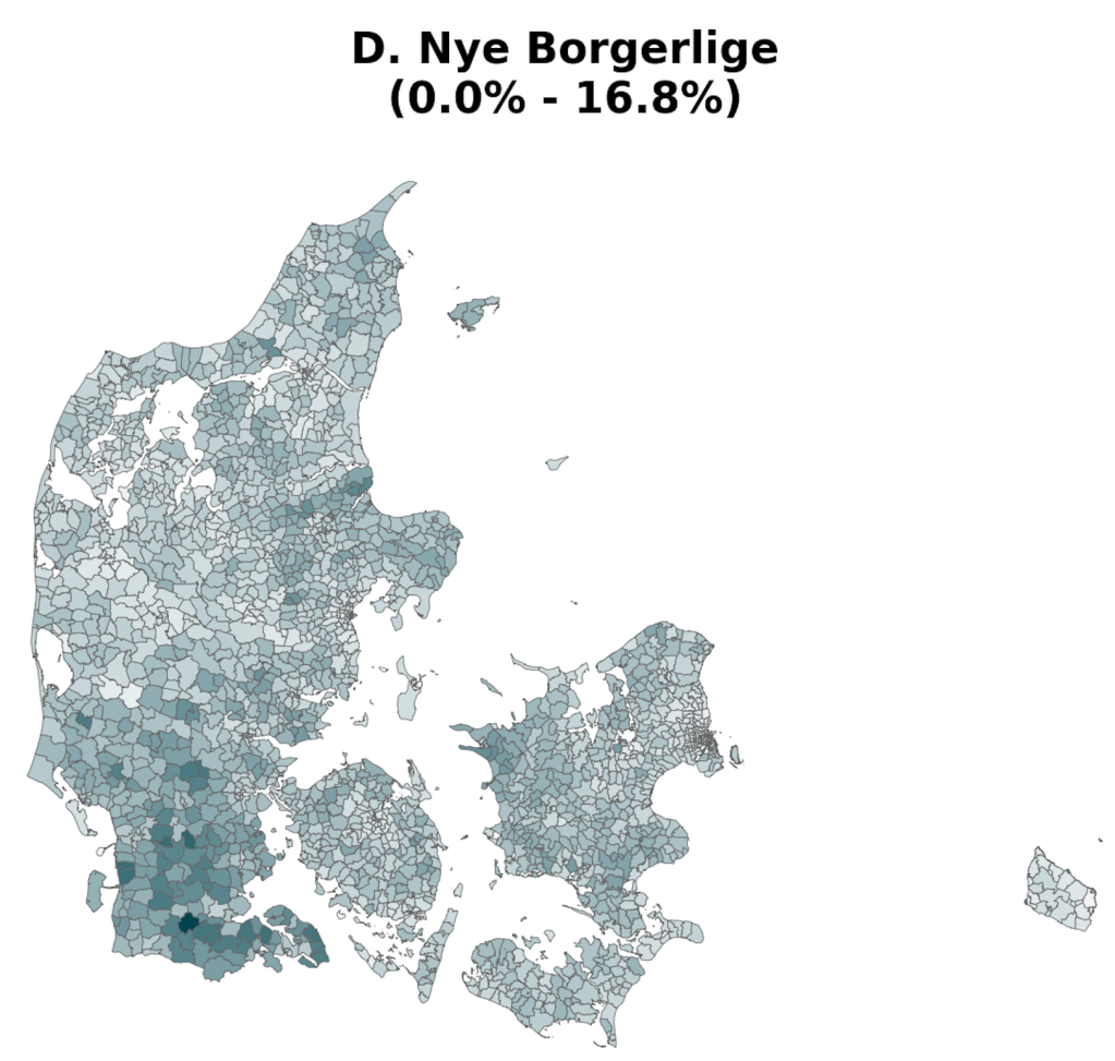
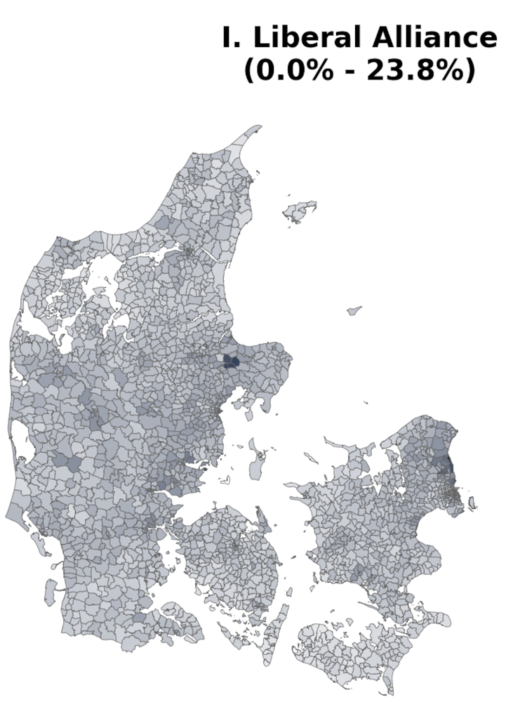
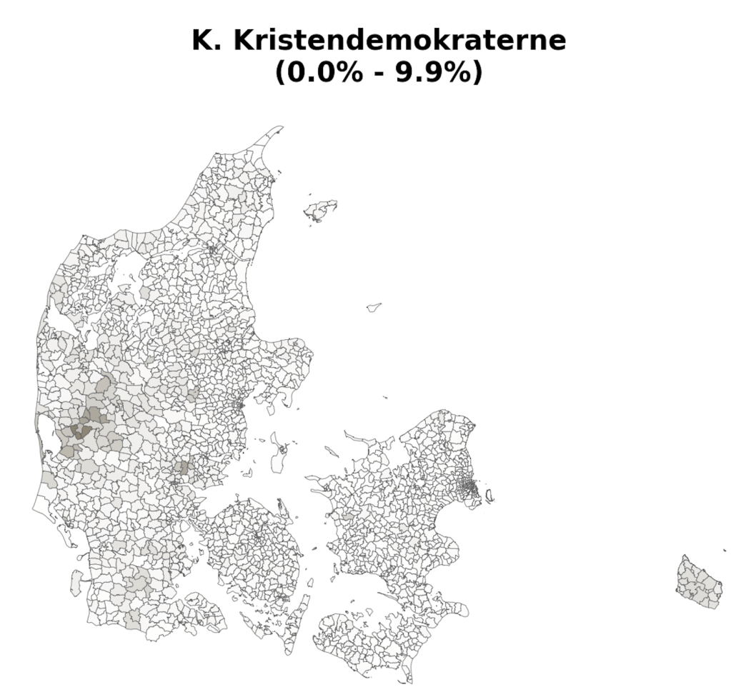
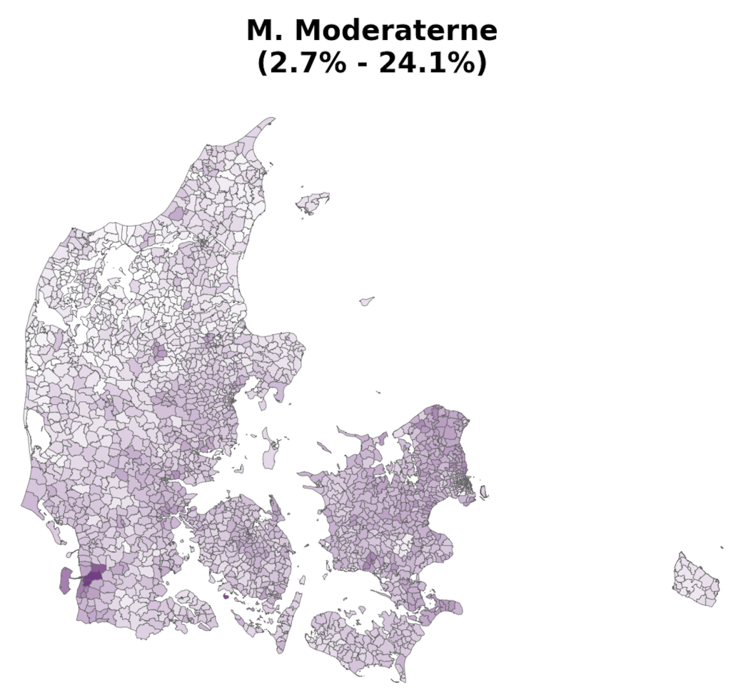
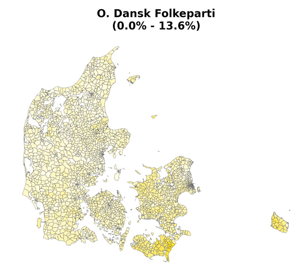
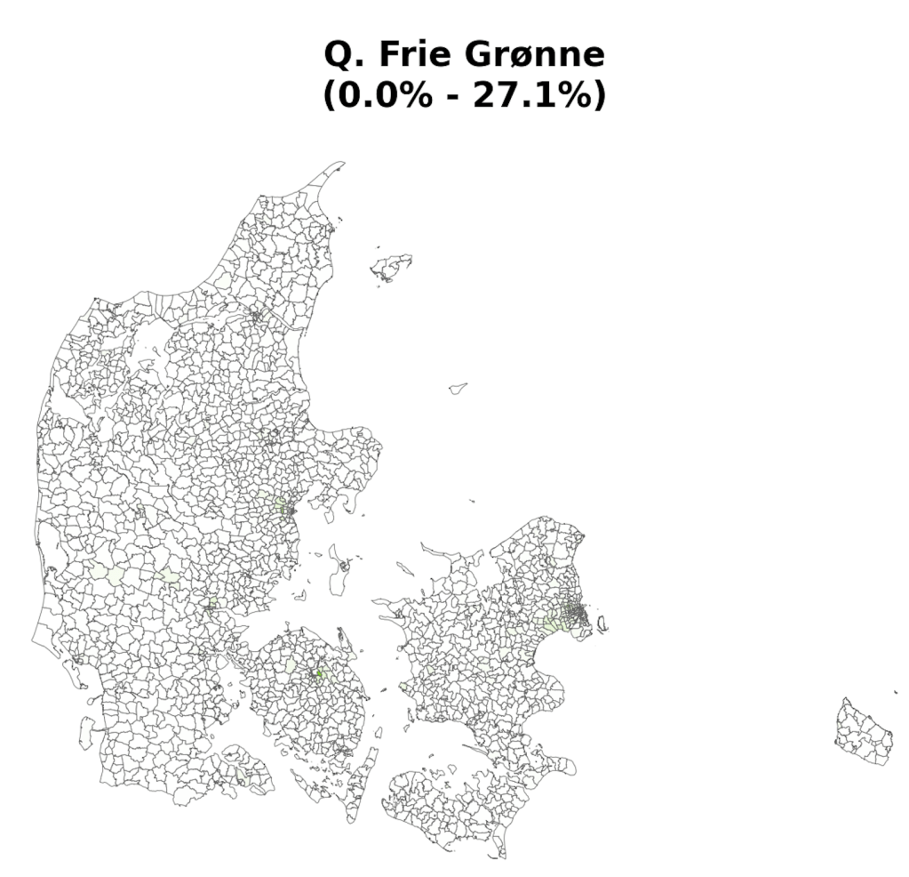
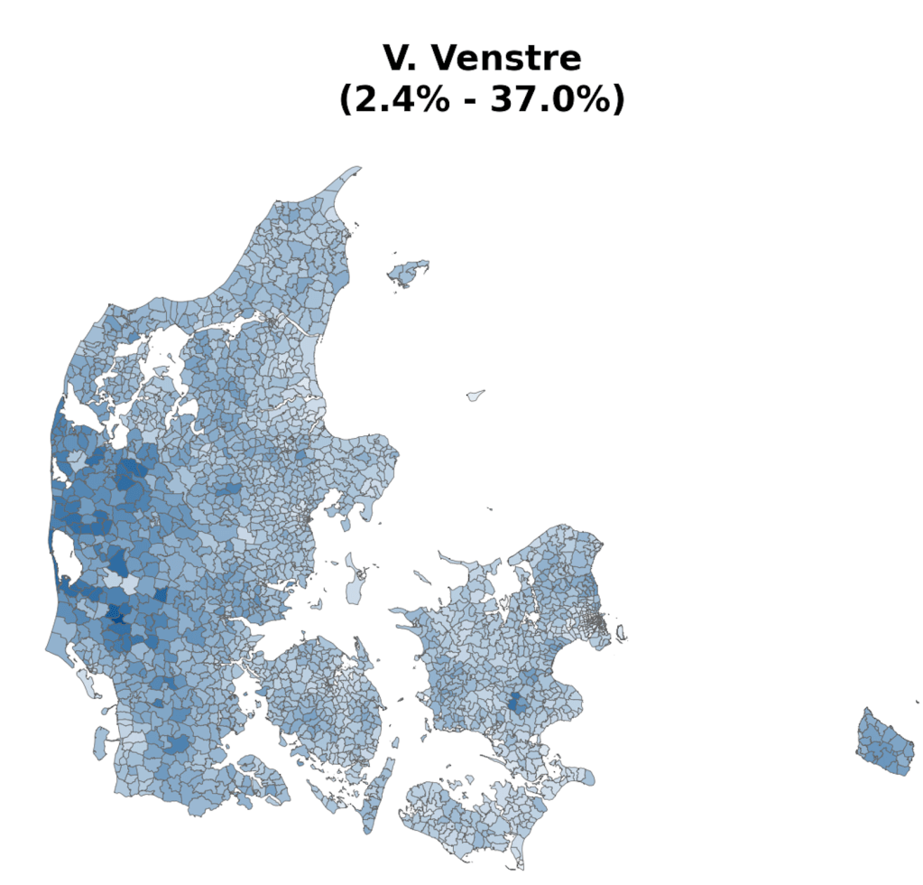
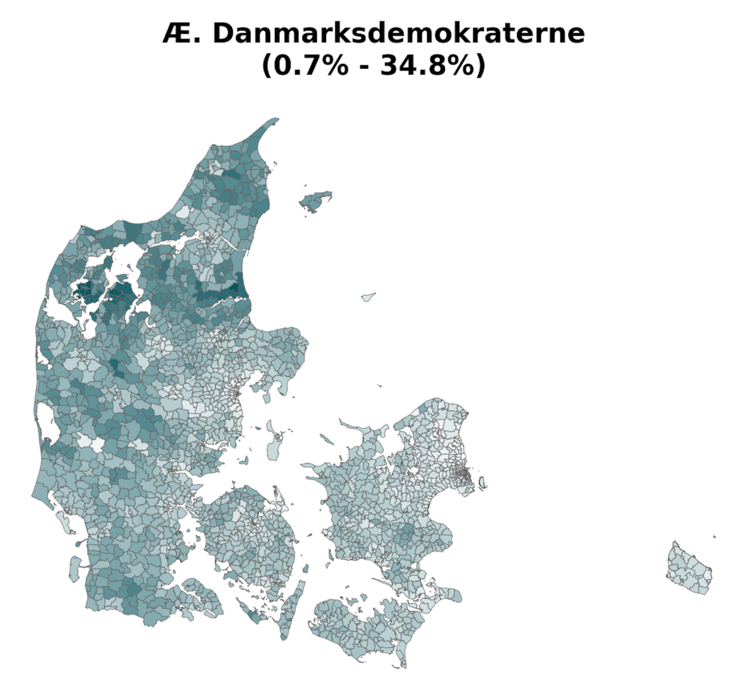
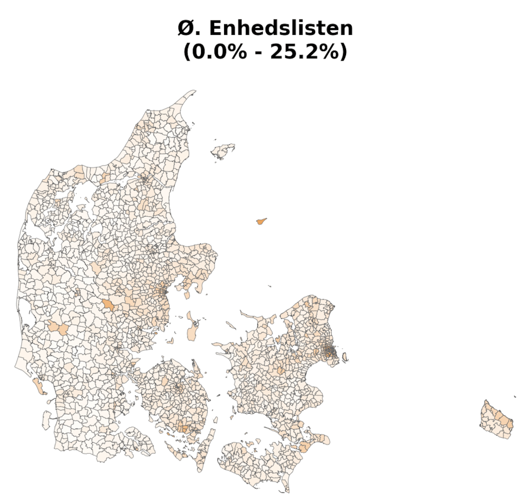
As part of a project on something completely different, the always brilliant Louis Boucherie generated these maps of voting in Denmark during the 2022 general election [1]. Maybe it’s me, but I can’t remember seeing voting at this resolution (parishes [2]) and I found resulting images surprisingly neat & interesting, so thought it was worth a post.


References
[1] Data from https://valgdatabase.dst.dk/
[2] Note that parishes don’t align perfectly with constituencies, so some values are interpolations.
And if you’re really interested there’s a nice PDF with “infinite” zoom that I can send upon request.

Leave a comment